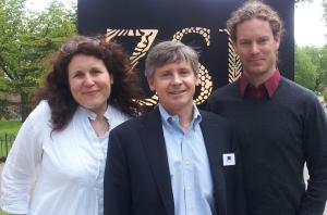
Post provided by Dr Nathalie Pettorelli
Nathalie is an Institute Research Fellow at the Zoological Society of London. She heads the Environmental Monitoring and Conservation Modelling (EMCM) team and her main research involves assessing and predicting the impacts of global environmental change on biodiversity and ecosystem services. Nathalie was one of the presenters at the UK half of the Methods in Ecology and Evolution 5th Anniversary Symposium in April. You can watch her talk, ‘Harnessing the Potential of Satellite Remote Research’ here.
If there is one question I hear over and over again, it’s this: “why, oh why, do you use satellite data instead of ground-based data in your research?” People seem to think that I believe satellite data are better than ground-based data. Do I not value fieldwork? Do I not trust ground-based data? My answer to all of this is: you’ll never catch me preaching that satellite remote sensing can solve the entire data collection gap in ecological monitoring.
I use satellite data because a lot of my work happens at relatively large spatial and temporal scales, targets regions where ground-based data are simply unavailable or extremely difficult to gather and relies on being able to access data that have been collected in a systematic and scalable manner.
Yes, satellite-based techniques can address spatial and temporal domains inaccessible to traditional, on-the-ground, approaches, but I am the first to acknowledge that satellite remote sensing cannot match the accuracy, precision and thematic richness of in-situ measurement and monitoring.

In spite of this, data collected on the ground are currently difficult to use for mapping and predicting regional or global changes in the spatio-temporal distribution of biodiversity (a problem for those of us trying to tackle these kinds of issues). Ground-based data can also be expensive and tend to come from a single annual time period. This makes it difficult to gather information on temporal changes and phenology.
Satellite remote sensing, on the other hand, offers a relatively inexpensive and verifiable means of deriving regular environmental information from everywhere in the world! It allows us, for example, access to data from dangerous or inaccessible regions. Also, satellite imagery can be used retrospectively, meaning that the data collected by satellites today will probably help solve issues we are not currently even aware of – an advantage which is invaluable.

Realising all this potential for satellite data to support ecological research and conservation is contingent on accessing relevant ground-based information though. Without contextualised knowledge gathered on the ground things like reliable data interpretation, adequate land cover classification and the development of new and useful satellite-based monitoring techniques would be impossible. There should be no competition between satellite remote sensing and fieldwork, there should only be collaborations.
However, there remain a series of challenges that must be overcome for satellite data to reach its full potential in terms of making a difference in ecology and conservation. For example, the cost of data acquisition and associated logistical requirements for processing and analysing large datasets can sometimes be prohibitive. In addition to this the integration of in-situ data, expert knowledge provided by local biologists and the technical expertise of remote sensing analysts is often limited. Opportunities to overcome these challenges have never been greater though. Clear desires have been expressed by the conservation and remote sensing communities to develop stronger, more efficient ties.

I sometimes worry about the future of Earth Observation satellite programs – specifically the ones that have supported our community for decades. Interestingly, many ecologists seem to take satellite data for granted, not realising that programs can be cut without warning. It is undeniable that having access to long-term satellite data has allowed ecologists and environmental managers to increase their understanding of the natural world, to make predictions about how this world might transform and to design efficient mitigation and adaptation strategies in the face of global environmental change. In this respect, ever-increasing user demands on satellite data resolution and capabilities need to be balanced with a recognition that continuity and interoperability matter.
The importance and difficulty of maintaining long term datasets is not a new topic to our community: many struggle every year to secure that extra bit of funding that will allow them to keep surveying their population; others spend hours trying to convince possible funding agencies that continuing to invest in their project is worthwhile, even though it has been going on for years. We know how many ecological processes can only be unveiled through the acquisition of long-term data and we are very well placed to appreciate how ending programs such as Landsat or Polar Operational Environmental Satellites could have a devastating effect on ecological research. As key end users, ecologists and conservationists need to be aware of the pressures faced by space agencies. We need to support the implementation of open access policies by all major space agencies around the world and, whenever possible, voice our concerns over potential changes in Earth Observation satellite programs’ priorities and data access. The maintenance of long-term Earth Observation satellite programs – like the maintenance of long-term and ground-based monitoring projects – is worth fighting for.

Watch Nathalie’s Methods in Ecology and Evolution 5th Anniversary Symposium presentation, ‘Harnessing the Potential of Satellite Remote Research’, here.

3 thoughts on “In Defence of Satellite Data: The Perfect Companion to Ground-Based Research”